Wednesday, October 20, 2010

Day 20: Eufala Lake, OK to Santa Rosa, New Mexico


Sign near Amarillo, Texas.
 Cross near Amarillo, TX.
 We stopped at this truck/travel center. Between Amarillo, TX and New Mexico.

 New Mexico has an impressive welcome to visitors; this sign stretches across the freeway. Also, a mile later was a very impressive Welcome Center with two staff people and a lot of information.
 These are common in our campground. One does not want to pitch a tent on top of these ant-hills.
 The Pig Out Palace, near Lake Eufala, OK, is sort of 'in-your-face' with their message. The interior of the restaurant had a lot of pig-themed items. We ate sensibly and did not do anything to regret. We did not really pig-out, so we 'got out'!

 Ummmm, this scupture was at our camp ground at Lake Eufala. Caren suggested I 'ride the bull' but you can see that this is not really possible. For several reasons.
Moon at our campground in Santa Rosa, New Mexico.
New Mexico; Land of Enchantment (their motto). We drove around 525 miles today; all of it on I-40 which is a pretty good interstate. We started the day by finding a diner close to our campsite at Lake Eufala. It was called the Pig-Out Palace and we could not resist. Some photos are attached. Crossing Oklahoma was uneventful and we crossed into the Texas panhandle. Between Amarillo, TX and the border of New Mexico we took a picture of a 190 foot tall cross which was supposed to be the world's largest but Caren googled that and found some folks in Illinois have erected a 198 foot tall cross. That's cool. We also found a truck stop which used its signs to advertise the owner's faith in Christ. We found that really interesting and made a point of stopping there. Sadly, it looked like many truckers were passing it up in favor of a Flying J truck stop just down the road. I suspect they were rejecting the first truck stop's bold statement that "Jesus is not a swear word".....that was all over the truck stop's large signs. Here in New Mexico we're about two hours from Albuquerque and plan to stop there for lunch and to ride the worlds 'longest' tramway to the top of a mountain. Then on to Arizona although we may not get there tomorrow. I like New Mexico. A lot. Red rocks. Temperature...just right. Interesting scenery. Hope you enjoy the pictures.

Tuesday, October 19, 2010

Day 19: Lawrenceburg TN to Checotah, OK

Yeah! around 600 easy miles today; we had fun and spent about half the day on backroads and half on Interstate 40 (which will take us into Arizona in two days or so). We had wanted to stay at David Crockett state park last night but found it closed. Just as well, really as we holed up in a motel and got an early start today. Visited Mississippi briefly today. Caren was impressed with some cotton fields we saw so we stopped at the side of the road and picked up a little which had fallen out of trucks hauling it to market. Pretty cool. In Mississippi we saw miles of Kudzu-infestation; we saw some of that in N. Carolina and TN, as well. Kudzu is an invasive vine, not native to the US, and it likes the South. It's out-of-control and looks like something from a horror movie. We saw---literally----it climbing telephone and electric poles, engulfing abandoned houses and other structures, and killing trees. I hope folks find a way to control it. Then, as we crossed into Arkansas we stopped at a supermarket in a small town. There I snapped a photo of the rig next to ours in the parking lot. I'm uploading it to this post.  In addition to a lot of things named....wait for it...... BUFORD, we actually spotted a Billy Bob creek and Billy Bob road (photo attached). Now, for a little Okie humor......as we got close to Checotae (famous home of the 2005 American Idol, Carrie Underwood) we took a couple of photos. We're camped on a big lake called Eufala. Just before the lake we found a road with a peculiar name....see the photos for the rest of the story. And we saw some good scenery but I have to say Caren took up knitting again after a few miles of Arkansas. Tomorrow it's New Mexico....I hope.....

 Oh when them cotton balls get rotten, you can't  pick very much cotton (Credence Clearwater Revival)
 Kudzu, the vine that ate the South...
 It's confirmed. Billy Bob lives!
 More and more steeples. A bad day for construction, though; no new pics.
 An amazing shot captured by Caren as I'm busy driving.
 Look closely. It says......   "Lotawatah Rd."
 Eufala.   Now put it together, with the lake first.......      Eufala (in a) lotawatah.
And some may believe Oklahomans do not have a sense of humor!

No kidding; someone in Arkansas drove their lawn tractor to the shopping market; when we had finished our shopping and left, the rig had gone.

Monday, October 18, 2010

Day 18: Kingsport TN to Laurenceburg TN

Today, a little over 420 miles traveled but much of that through mountains; the Great Smoky Mountains National Park was worth the slow drive and the hour or two of serious traffic congestion on the approach. Fall is definitely the time of year to visit the Great Smokies; without the fall foliage the park would be much less interesting; nothing much would set it apart from places I've been such as the Bighorn Mountains of Wyoming. After leaving the park we again turned west in our travels and found ourselves able to swing through a very small town called Sewanee, TN. Sewanee's main claim to fame is that it is my birthplace....oh, and the University of the South is located there, which is where my father earned one of his college degrees....some 56 years ago. I suspect the place looks much the same now but I can't really say since I have not been back and my family moved away from there when I was only a year or so old. Both my parents are passed away now and I am thinking how much I'd like to visit with my mom (passed away about a year and a half ago) to let her know I visited Sewanee....Anyway, Sewanee is very small (Canyonville is much larger, I think) but the University buildings are beautiful old stone buildings.
We should cross the Mississippi River tomorrow just south of Memphis TN and get into Arkansas. Then it's a straight run across the Great Plains enroute to the Grand Canyon, Bryce and Zion National Parks, and of course, in all of that, the Rockies!
 Great Smoky Mountains, looking south into North Carolina.
 The great photographer being surreptitiously photographed. Great Smoky Mountains NP.
 More Great Smoky Mountain scenery.
 The authors and co-conspirators. We may not come home.
 Emily, your mother is taking these shots from within the car. I am driving.
 I don't think this fellow appreciated Caren taking his picture. He looked decidedly unhappy.
 Our humble abode last night; there's a folk song Caren and I can play on our guitars and we used to sing it a lot with our elementary classes; it's called "Rocky Top" and takes place in 'Rocky Top' Tennessee....so we did not pass up the opportunity to stay in this RV place.....we have frequently been the only tent campers in many of the places we've been. Summer crowd is gone and the older, retired folks mostly are RV'ers....we are exceptional, of course....   :)
 A sweeping curve in North Carolina...still in the Great Smoky Mountain NP.
 There. We've been to Sewanee. It's a circle of life thing....

Sunset in southern Tennessee, perhaps most interesting is the dirty spots in the photo, which, of course, since Caren took the photo through the windshield, would be.....bug spatter from several states. I did clean the windshield earlier today!

Sunday, October 17, 2010

Day 17: Harrisonburg VA to Kingsport, Tennessee

Today we drove----again, a leisurely 350 miles----through Virginia to just across the northern border of Tennessee. While we don't plan to visit Sewannee, TN, it is my birthplace. But Tennessee is said to be a beautiful state. We did find Virginia very much so; we drove through the Shenandoah National Park today. It being Sunday, there were no road repair crews to take pictures of.....but we did get some pretty good scenery photos and also took pictures of our campsite, here at Rocky Top campground & RV camp, near Kingsport, TN. Tomorrow we should see the Great Smoky Mountains National Park-----another park I've wanted to visit for a long time. After that we should proceed pretty much west. But first, there's the matter of the Cracker Barrel restaurant, which we've heard much about from friends of ours. Apparently they're a big chain here in the south so, as luck would have it, there's one right at the on-ramp to the Interstate we'll take in the morning. So we'll just see for ourselves.

 This is the second really big cross we've seen; both were set up by Baptist churches, who sank a lot of money into this effort. Impressive, and to my way of thinking, a good use of their money. The size of these make them impossible to 'not see' as you drive on the interstate. It has been very interesting to see the relative presence or absence of various denominations as we've traveled around through Canada & the New England states and now through the upper South.
A sample of the scenery of the views from the Shenandoah National Park ridgetop drive. Overlooking the wide Shenandoah Valley. A number of important Civil War battles took place here.

Day 16: Milford PA to Harrisonburg, VA.

We dawdled but made around 350 miles. Spent 3 hours or so hiking around the Gettysburg National Military Park, in Gettysburg, PA.  We spent time looking at Cemetery Ridge, where the Union soldiers repulsed Confederate charges by General Pickett and General Jackson; after 3 days' battle the Confederates withdrew having lost 23,000 men wounded or killed (of their 70,000 starting number) while the Union forces lost 20,000 (of their 93,000 starting number).  The carnage must have been truly incredible; it was rather moving to walk on the same stones which sheltered the Union soldiers. We saw 'Round Top' and the very fields across which much of the fighting raged (but the whole battlefield is about 25 square miles). Anyway, this battle marked the turning point of the Civil War. It was costly. Most of the pictures we took are on the Nikon or Caren's camera and I won't upload them yet. But I will upload the address President Lincoln made----we stood on the very spot he spoke----when he dedicated a portion of the battlefield as a National cemetery (which he did on November 19, 1863---the battle took place July 1, 2, and 3 of 1863).

Friday, October 15, 2010

Day 15: Rochester NH to Milford, PA

A little better days' travel today; we did negotiate a couple of large towns but all in all, despite the sopping weather, we think 350 miles is OK. We really liked Route 9 across Vermont and also the part of New York we traversed the last 100 miles or so. Despite the storm, there's still plenty of color. We just crossed the border into Pennsylvania a few miles back and stopped for the night here in Milford, PA. It's a small town and not too remarkable. We're going further south and east tomorrow; planning to travel down through the Appalachians and get to the Great Smoky Moutains National Park in a day or two. Posting a couple of pictures; I've been busy driving and some of the narrow streets in the towns we passed through today made that difficult; however, I did get Caren's camera away from her long enough to download some pictures and I'll post a few.

 A New York hillside from Interstate 88 just a few miles from the Pennsylvania border.
 We have many pictures of steeples. I cannot tell which city they are from, in most cases.
 We stopped here and bought a little maple sugar and syrup from a family farm, whose 400 acres has about 4000 sugar maple trees and they've been in the sugar maple business since the late 1800's. Also they appear to be Scottish terrier fanciers, and we were in Marlboro county, NH and actually on Marlboro Road.
 Southern New Hampshire with light rain from the 'noreaster'.
 Told you yesterday; here's the evidence!
A bluish, painted moose sculpture in Bennington, NH.

Day 14: Bar Harbor to Rochester New Hampshire

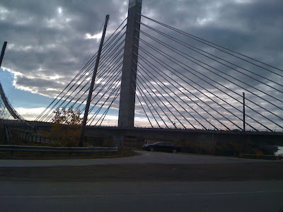
Approaching a coastal bridge.

 I like this picture; took a lot of them from this spot using the Nikon. The picture below is from our room looking into the motel parking lot this morning. It does not capture reality; but we like the sound of the rain OUTSIDE and are glad we choose not to stay in the tent last night.
So, day 14: Yeah. It's only 200 miles or so. But they were grueling, through congested, crowded, narrow streets, where we either annoyed some drivers because we'd only drive five miles over the speed limit, or because we wanted to see the road signs rather than them be a blur due to our car's velocity. We drove through Kennebunk, ME and through a number of other busy places. There were lengthy delays due to construction. We finally decided to head inland, away from the coast and that proved a blessing. We did see some of what we imagined New Hampshire to be; narrow country roads with little traffic and outstanding foliage. We made an early stop around 5:00 PM and decided to stay at an inexpensive inn called the "Greenwood Inn". It has pretensions of grandeur, but the room was clean, did not smell, and was pretty quiet. Except for the re-assuring sound of rain. A big 'nor-easter' blew in and is dumping 1-3 inches of rain to be followed by winds of up to 50 mph gusts. Makes this ol' Oregon coast boy feel right at home. And it's a fairly warm rain. But the wind should knock most of the leaves from the trees. Anyway, we'll point the Acura south and to the west today and should begin working our way into better weather as we go. This is a large storm and we may still have some showers tonight even though we are going in the opposite direction from the storm. Oh.....and still learning things about Caren after these 30 great years.....she's got this fascination with old churches with spires so she's been snapping photos like crazy...she's kind-of worked through taking pictures of cemetaries (probably because she's running out of memory cards)---but the latest thing I've noticed is that she's taking photos of flaggers at the road construction sites. This alarms some of them. And me. I will keep tabs on that and post the evidence from her camera when I can get hold of it for a while. She may claim that she takes these pics because she does not want me to risk her life by using my cell phone camera when I should be driving, avoiding potholes (and other drivers), and looking out for pedestrians. But blame-shifting and denial are the first steps.....